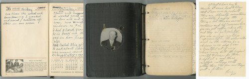
Etta Evans Gilmore was born in Fleming County, Kentucky, on February 4, 1885, to Robert Evans and Matilda Fawns. She married Henry Steele Gilmore, a Bath County physician, around 1906. Their son Robert was born in 1906 and daughter…

Website Search
Displaying results 26 - 50 of 533
Mariam and David discuss Charles Dickens’ visit to Kentucky in 1842, with readings by Bill Widener from Dickens’ work “American Notes.”
Enjoy this discussion of Lexington born Major League Baseball players that was cut from the KY Baseball episode.
Mariam and Wayne discuss the rich history of baseball in Kentucky.
Library meeting rooms are available for individuals, non-profit, for profit, study groups, and community organizations seeking to hold meetings, trainings, and workshops. Meeting rooms are free of charge. Sterno and other tools/equipment that have an open flame are prohibited.
Please agree to these terms and conditions to submit a meeting room reservation request.
Jennifer and Erin review recipes from four Kentucky Cookbooks: Southern Girl Meets Vegetarian Boy by Damaris Phillips (Pimiento Cheese Baked Rice), Bluegrass Gatherings: Entertaining through Kentucky's Seasons by Junior League of Louisville (Beer Cheese),
The Central Kentucky Cemeteries Maps are powered by Google Maps. Counties include: Fayette, Bourbon, Clark, Garrard, Harrison, Jessamine, Lincoln, Madison, Mercer, Montgomery, Nicholas, Powell, Scott, and Woodford.
The Lexington Public Library’s Digital Archives provide open access to researchers and students to learn more about the rich history of Lexington and Fayette County. It contains a fraction of the Library’s physical holdings, which are housed and available for reference in the Kentucky Room at the Central Library. New material is being digitized and added constantly, so there's always something new to find.
Search, view, and download digitized historical Lexington, KY Newspapers covering the 18th, 19th and 20th centuries.
Content from over 80 Kentucky newspapers and news sources, including the Lexington Herald-Leader.
Library meeting rooms are available for individuals, non-profit, for profit, study groups, and community organizations seeking to hold meetings, trainings, and workshops.
Celebrate Lexington, Kentucky’s 250th anniversary all year long. Join us for programs, galleries, podcasts, and more highlighting our city’s history, heritage, and legacy.
Celebrate Black History Month at LPL
Throughout February, join us as we celebrate Black history with programs, materials, podcasts, and more.
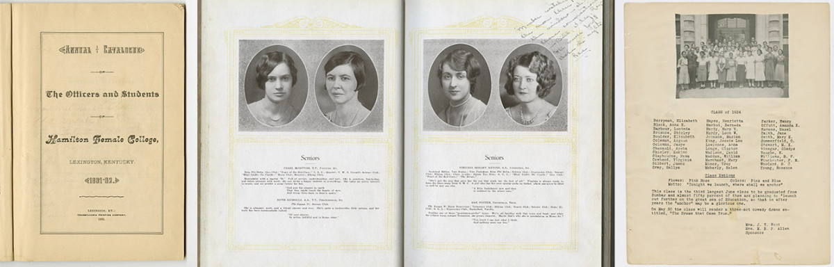
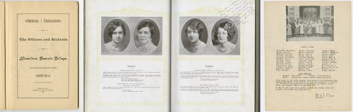
Schools and Yearbooks Collection
The Eastern Kentucky Review contains articles about Eastern Kentucky State Teachers College. This particular issue contains photos of buildings, graduating seniors, students, clubs, and activities, and includes photos and information about the Army Specialized Training Program for military training for World War II.
Collection Format
Collection Topics
All Digital Archives Collections
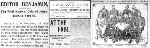
This collection consists of Black community news published under the headline “Colored Churches,” “In Colored Circles,” or “Colored Notes”; and other articles of social interest, including marriages, public events, and obituaries.
The item contains the history of Mount Horeb Presbyterian Church, photos and biographies of ministers and founding members, and a list of member names from 1827-1952.
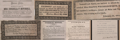
Compiled by Cyrus Parker Jones, a man formerly enslaved by the Parker family, these funeral notices cover 667 funerals of individuals in Lexington, including seven free blacks. The funeral notices cover the years 1806-1886. Jones…
The Daily Lexington Atlas ran from late 1847 through early 1849 and was Lexington’s first daily paper, and the first to publish information from the telegraph lines. It is described by William Perrin in his 1882 History of Fayette…
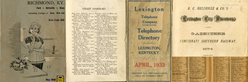
The 1906-07 Lexington cross directory contains residential and business information for the city, arranged both alphabetically and by street, with a business listing by category. It also contains city officials and departments, and…
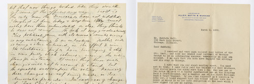
This collection of letters to and from portrait artist Sudduth Goff (1887-1965) is part of the library's Duncan-Goff scrapbook collection.
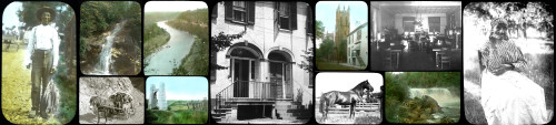
The Elmer L. Foote Collection is a group of 190 lantern slides. They were created by Elmer L. Foote, a Cincinnati photographer and library staff member whose pictures appeared in the Cincinnati Commercial Tribune.
The item is a history of the theater in Lexington from 1799 to 1850, including names of theaters, actors, personnel, and plays.
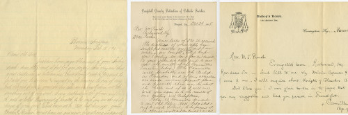
Letters to and from Father William T. Punch (1874-1933). Father Punch was instrumental in building the 3rd St. Peter Catholic Church on Barr Street in Lexington, KY.
The item is a brief report on methods to revitalize the Lexington commercial district through the preservation of architecturally and historically significant structures. It includes case studies on the Keiza Barton residence, Giron’s…
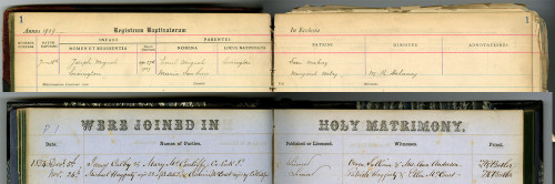
This half of the record book contains burial records for St. Paul Catholic Church parishioners.
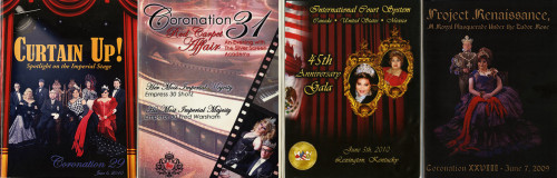
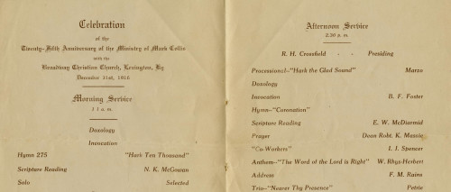
Program features the activities and accomplishments of the previous year’s Empress and Emperor while providing the layout of the current year’s coronation proceedings. Features advertisements for local businesses and photographs of the…
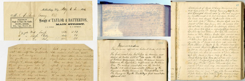
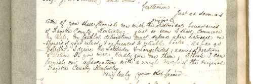
This letter collection was collected by Judge Kenneth Lyons. The earliest date of the letters is 1862, from Bourbon and Nicholas Counties, Kentucky. Some letters are fragments.
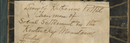
The diary (ca. 1899) of Katherine Pettit, details her settlement work for the Kentucky Confederation of Women's Clubs, made yearly trips to Hazard during this period and was a central figure in establishing the Hindman (Kentucky)…
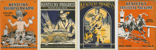
This issue contains information about Kentucky highways, colleges, and agriculture. It also features articles on Bardstown and the song “My Old Kentucky Home” by Stephen Collins Foster.
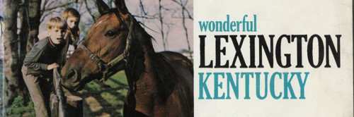
The item is a promotional pamphlet containing brief descriptions of various Lexington tourist locations.
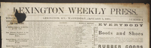
The Lexington Weekly Press was published every Wednesday in Lexington, Kentucky, and contained local, state, and foreign news. The paper focused on Central Kentucky’s “agriculture, manufactures and fine stock”, as well as literary and…
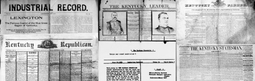
The Kentucky Leader was published from 1888 until the name changed in 1895 to the Daily Leader. They focused on local and national news. The Daily Leader was published from 1895-1901 until the name was changed to the Lexington Leader.…
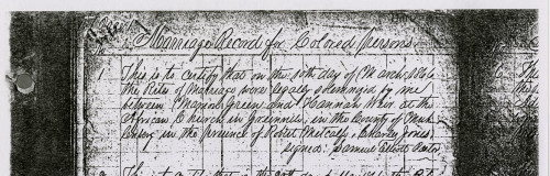
Scans of the Black Marriage records from the Courthouse in Greenville, Kentucky.
This is a handwritten series of lectures detailing Samuel D. McCullough's memories of his childhood and life in Lexington, Kentucky, accompanied by letters and a photograph of his house.
The Eastern Kentucky Review contains articles about Eastern Kentucky State Teachers College. This particular issue contains photos of buildings, graduating seniors, students, clubs, and activities, and includes photos and information…
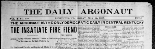
The Daily Argonaut began in 1895 and seems to have ceased publication in 1899. This collection includes scattered issues from 1895, 1896, 1897 and 1898.
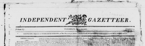
The Independent Gazetteer was founded and printed by James Charless in 1803, with ads appearing in the Kentucky Gazette about its upcoming publication. The first issue was printed March 29, 1803. The paper was later sold to Robert Kay…

The Kentucky Gazette was the first paper established west of the Allegheny Mountains. The frontier paper focused on East Coast and International news, though some local announcements can be found. Later, the paper focused on…
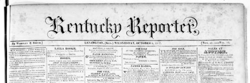
The Kentucky Reporter is the weekly continuation of The Reporter, which changed names in October 1817. It reports on local and national news. 1827 is the only semi-weekly run of this newspaper.
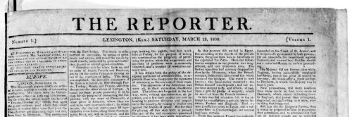
The Reporter was a weekly Republican paper, occasionally semi-weekly when Congress was in session. Continued publication throughout the War of 1812.
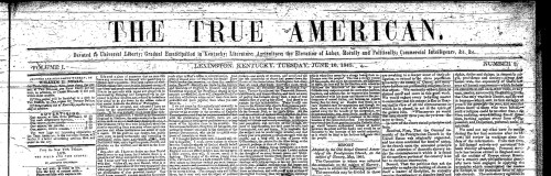
The True American was an anti-slavery newspaper started by Cassius Marcellus Clay in June 1845. He ran the paper in Lexington until August of 1845, when he published an article deemed so incendiary that at court injunction was issued…
The item is a yearbook for the United States Army Training Center at Fort Knox, Kentucky, and contains photographs of the officers, NCOs, and graduates of the 8 week basic combat training. There are also many photographs of the various…
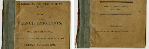
This work contains information about French Emigrants to America over the years 1789-1799, and provides a history of the French Revolution. The work was originally in French, and was translated into English by an anonymous translator…


